← Back to work

Rail transit · Spatial systems / V18

Station modelling, patrols and incident coordination

A V18 product demonstration connecting editable station spaces with patrol locations, personnel states and incident response.

Product and interaction exploration2026Xiaokuang Dong

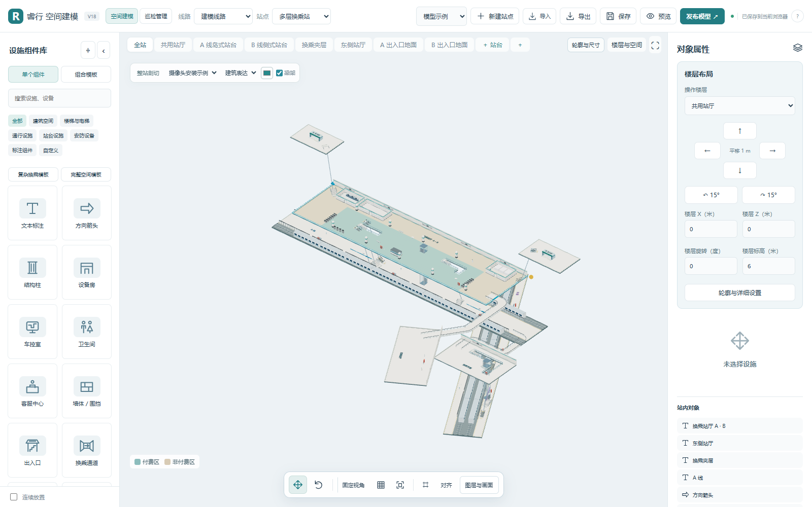
Station modelling, patrols and incident coordination: public demo interface in Chinese
Actual demo interface in Chinese. Data and states are illustrative, not live operations.

THE THINKING / 02

From the problem to a working approach.

How can one station model support both patrols and incident response?

01 / Organise space

Begin with usable spatial relationships.

Model floors, rooms, equipment, entrances and connections. Edit, save and export objects that provide context for subsequent workflows.

Read the design choice

Design choice: spatial objects need identities that workflows can reference.

02 / Locate patrols

People and equipment share the same scene.

Navigate from the network to a line and station. Inspect personnel positions, tracks and status in their spatial context.

Read the design choice

Design choice: combine location and status to support coordination.

03 / Coordinate response

Carry spatial context into the incident.

Explore reporting, localisation, support, acknowledgement, arrival and field feedback using the same spatial relationships.

Read the design choice

Design choice: spatial information follows the work, beyond visualisation.

SPATIAL RELATIONSHIPSILLUSTRATION
L1B1B2SPACE / PEOPLE / EVENTS

Design choice: spatial objects need identities that workflows can reference.

APPROACH & DEMONSTRATION SCOPE

The operational question

Rooms, floors, entrances, stairs, equipment and platforms provide the physical context for patrols and response. A useful spatial model needs to connect these objects to the work taking place around them.

This English overview accompanies the Chinese case study. V18 combines station modelling, patrol views, communication and incident exercises using shared spatial relationships. The models are product demonstration samples, not surveyed station plans.

Explore the demo

The interface is in Chinese. Start with 空间建模 (spatial modelling), select a floor and inspect an object. Model editing supports undo, import, export and saved views. 巡检管理 (patrol management) connects the network, lines and stations to personnel locations, tracks and status.

Incident exercises cover reporting, localisation, assessment, support, acknowledgement, arrival and feedback. Camera footage is prerecorded demonstration material, not live surveillance.

Saving and session behaviour

Draft models and published snapshots are saved in the current visitor’s browser. Clearing site data removes those changes; export important models to a file. Patrols, dispatch and incident reports are temporary exercises that restart on refresh.

This public version does not provide cross-device collaboration or shared operational storage. It demonstrates the product workflow; deployment into an operational environment would require appropriate identity, permissions, storage and audit controls.

Read the full Chinese case study.